Date of hike: Sun.
April 22, 2012 Earth Day!
Weather: 9C at start; 11C at completion; partly cloudy/sunny with a NW wind
Duration of hike: 1 hour 27 minutes

This was the third stretch of the TV Trail that took a
detour along the local roads, and it won’t be the last. Usually, following a roadway is necessitated
by the fact that private land ownership does not allow hikers to come onto the
property, should the trail pass that way.
That was the case here, as we left Kains Woods and headed through a
housing development and made our way to Westdel Bourne and on through to Oxford
Street.
 Had we continued along the
river, we would have traversed onto the properties of local home owners as well
as that of Woodeden Camp (a camp for
physically challenged children that is operated by Easter Seals). I guess it’s just unfortunate that the trail
would have to pass through these properties, in order to stay its course along
the Thames River.
Had we continued along the
river, we would have traversed onto the properties of local home owners as well
as that of Woodeden Camp (a camp for
physically challenged children that is operated by Easter Seals). I guess it’s just unfortunate that the trail
would have to pass through these properties, in order to stay its course along
the Thames River.
On one hand, one would hope that a compromise of some sort could be worked out, but on the other hand, I suppose it’s understandable that the privacy of these properties needs to be respected.

Nevertheless, we set out to complete this part of section 6 in a steadfast, no-nonsense manner. Short on time, this particular day, we were able to get the job done efficiently. All the while, I couldn’t get the Beatles tune “The Long and Winding Road” out of my head as we made our way along the side of the road. I also began to reminisce about when I was 9 or 10 years old, participating in the annual Oxfam Walk that was held in my hometown of Chatham. Perhaps this was when I first developed an attraction to setting off on a challenging journey, such that a hike can be.
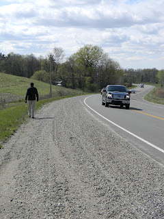
Eventually, I became involved in middle distance running at the high school and university level and took on the ultimate challenge of running the marathon (26.2 miles). I would conquer that 30 mile distance (more or less) and successfully complete 14 marathons, with all but one race under the 3 hour time barrier. Hard to believe when I struggled to simply walk an equivalent distance! But I do digress….easy to do as one walks along a road with little else but thoughts and Beatles tunes going through one’s head.


“Section 6 from the North end of Westdel Bourne – at 2.5 km
This short leg of our adventure may not have offered
much in the way of scenery or a chance to mingle with nature, but I’m surprised
to see that the length of this post is substantial nonetheless. I guess it just goes to show that even the
simplest outdoor excursion, on a spring day, can provide not only physical
stimulation, but a mental one as well.
Good for the body AND soul!
Weather: 9C at start; 11C at completion; partly cloudy/sunny with a NW wind
Duration of hike: 1 hour 27 minutes
Section: 6—from Tigerlily
Road/Riverbend Road to the entrance of Komoka Provincial Park on Oxford St.
Distance: 6.4 km Cumulative distance: 153.5 km

 Had we continued along the
river, we would have traversed onto the properties of local home owners as well
as that of Woodeden Camp (a camp for
physically challenged children that is operated by Easter Seals). I guess it’s just unfortunate that the trail
would have to pass through these properties, in order to stay its course along
the Thames River.
Had we continued along the
river, we would have traversed onto the properties of local home owners as well
as that of Woodeden Camp (a camp for
physically challenged children that is operated by Easter Seals). I guess it’s just unfortunate that the trail
would have to pass through these properties, in order to stay its course along
the Thames River. On one hand, one would hope that a compromise of some sort could be worked out, but on the other hand, I suppose it’s understandable that the privacy of these properties needs to be respected.

Nevertheless, we set out to complete this part of section 6 in a steadfast, no-nonsense manner. Short on time, this particular day, we were able to get the job done efficiently. All the while, I couldn’t get the Beatles tune “The Long and Winding Road” out of my head as we made our way along the side of the road. I also began to reminisce about when I was 9 or 10 years old, participating in the annual Oxfam Walk that was held in my hometown of Chatham. Perhaps this was when I first developed an attraction to setting off on a challenging journey, such that a hike can be.

The Oxfam Walks were held in the spring across Canada,
and Chatham/Kent County was no exception.
I remember the course being 30 miles (yes, 30 miles, not kilometres!) in
length and participants would get sponsors to pledge for each mile they would
complete. There were check points along
the way, and your card was stamped to prove that you had made it to that
destination. I tried twice to make the
full distance, but only ever made it as far as 18 miles, before my blistered
feet and sunburned shoulders forced me to abandon my goal and wait for the
paddy wagon to pick my friends and me up.
When I think of it now, I am in wonder that my parents allowed me, a 9
year old child, to set off for the day, to try to accomplish such a feat. But they did, and I survived! Though I was always in awe of other class
mates who had succeeded; how did they do that?
After a couple of years, the annual event was no more, for reasons that
I am not aware of, and I never did get a chance to beat that course.
Eventually, I became involved in middle distance running at the high school and university level and took on the ultimate challenge of running the marathon (26.2 miles). I would conquer that 30 mile distance (more or less) and successfully complete 14 marathons, with all but one race under the 3 hour time barrier. Hard to believe when I struggled to simply walk an equivalent distance! But I do digress….easy to do as one walks along a road with little else but thoughts and Beatles tunes going through one’s head.

Still, there were some interesting things to observe
along this early part of Section 6. This
lovely little country church, set back from the road, attests to a simpler
time.
Located just east of the church,
along the road, was this small cemetery.
We took a few minutes to explore it and observed many similar family
names, with dates going back as far as the early 1800’s! Many stones were indecipherable due to the
weathering of time. 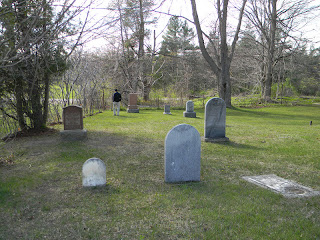

This section, if travelling from Talbotville to St.
Mary’s, begins with an exit from Komoka Provincial Park. One of the smaller parks in Ontario, and
lesser known, its boundaries protect the terrain and species in this area. A provincial park for only about 10 years,
there seems to be a change in the making happening, in order to classify it as
a Provincial Nature Reserve. I’m
guessing that this will bring further restrictions to activities like horseback
and ATV riding through the area, which will only help to preserve its natural
state for years to come. We’re looking
forward to hiking the trail through here on our next leg.

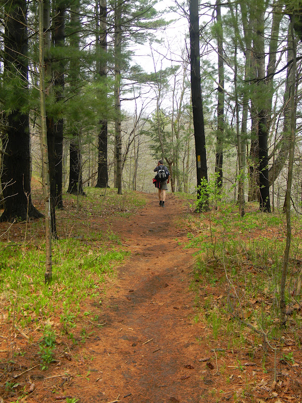
 |
| Where the trail begins its entry into Komoka Park |
 |
| Beginning of trails in Komoka Prov. Park....our turn-around point for this leg....our starting point for the next. |
When hiking Section 6, one should be aware that there is
a slight trail re-route. By checking the
Thames Valley Trail Association web-site and following the link to “trail
re-routes” under “The Trail”, changes that have occurred since the publication
of the third edition of the trail guide are posted. One such important change for this section:
“Section 6 from the North end of Westdel Bourne – at 2.5 km
DELETE existing trail guide description
entirely.
ADD “At 2.5km turn R (east) off the
north end of Wesdel Bourne onto Kains Road. Follow Kains Road for 300 m and
turn L onto Tigerlily Road. Follow Tigerlilly Road for 50 m and cross over
Riverbend Road. Continue along Tigerlily Road for another 260 m to Riverbend
Road. Cross over Riverbend Road and continue on paved walkway on opposite side.
Follow the footpath as it curves L (north) around the storm collector pond.”
Section 6 from the North end of Westdel Bourne – at
3.2 km
DELETE existing trail guide description
entirely.
ADD “Pass through the opening in the
cedar fence and continue down the open corridor towards the river for
approximately 170 m (before reaching the outlet of the drainage spillway). Turn
right (east) and follow the trail into woodland.” ”
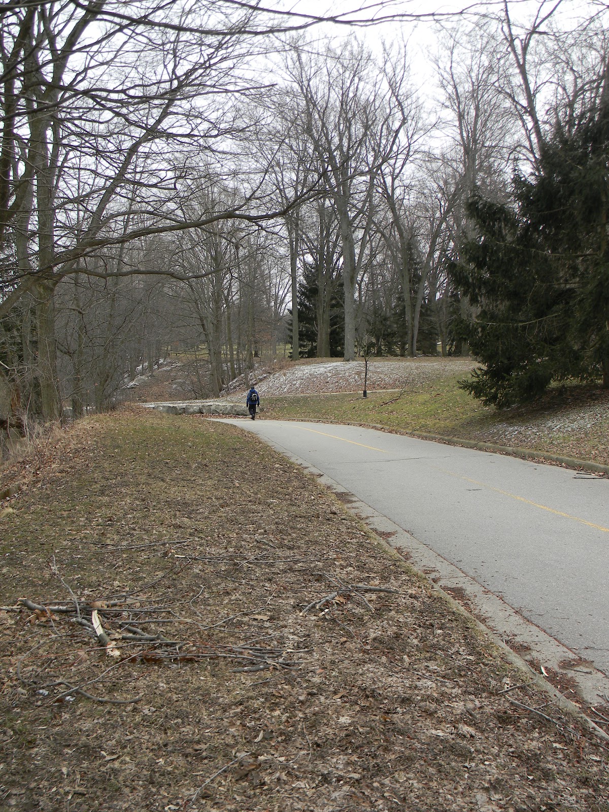
 |
| Paul, standing where the trail used to go....from this point, if heading east, turn onto Kains Road and then turn left onto Tigerlily Road. |
 |
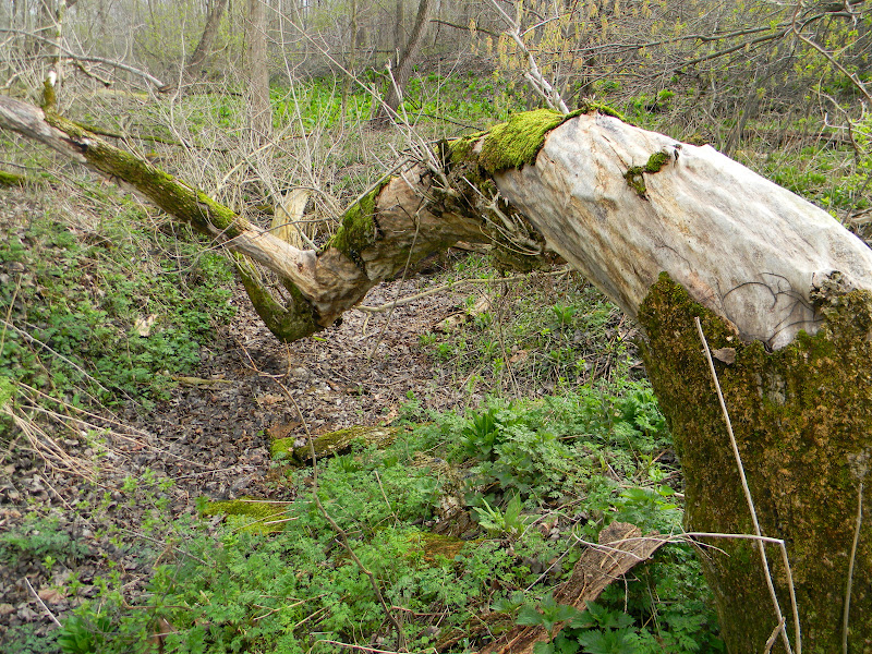
| This tree is defying the odds...notice the large gaping hole in its trunk and it was developing another set of buds! It was located on the cemetery property. |