Saturday, November 26, 2011

Git ‘er Done!

Date of hike:  Sun. Nov. 20, 2011                             

Weather:  8C, cloudy & overcast; NW wind @ 22km/hr
Duration of hike:  1 hour 25 minutes   Section:  11  (from Clarke Rd & Kilally Rd to Highbury Ave entrance into Kilally Meadows)
Distance:  7.2 km              Cumulative distance:  86.3 km
Picking up from where we left off last
time--the turn onto Kilally Rd from
Clarke Rd.
After crossing the Clarke Road bridge over the Thames River, the trail heads west on Kilally Road to Highbury Avenue, well away from the river’s edge.  This is the second time the trail has to follow along roadways, as private land ownership doesn’t permit passage through. 

There are only a few homes built along this stretch, one of them being the very stately property known as “The Spinney”.  This country estate has been here for quite some time and was once the family home of former Ontario Premier David Peterson. 


Unlike Valleyview Road, this section offers few, if any, glimpses of the river along the way, so we had to settle for whatever hidden treasures we could find as we trudged along. 
Tree on the edge of the Spinney--completely bare of
its leaves, providing a stark contrast to the greenery
behind it.

The last of the sumac against the overcast
November sky.
The only real view of the river that we got was the one from the Highbury Avenue bridge.  Looking east, we were surprised to see the small island formation in the river; something we had never noticed before. 

After all, it isn’t easy to see over the bridge’s solid rails as you drive across it in a car.  But there it was, beautiful and completely hidden from the eyes of most people.
Kilally and Highbury--waiting to cross
and continue north on Highbury.

The turn around point--Highbury Avenue
and into Kilally Meadows.
This was the shortest hike we’ve completed to date.  We didn’t do the full distance of this section due to time constraints, but we did complete the least exciting part of it, just to get it done and out of the way.  Next time, when we complete the other part of Section 11, we will actually be able to walk from our home to the starting point, rather than driving in the car.  The trail is now getting closer to our “own backyard”, so to speak, and we will be retracing our steps on paths that we’re very familiar with. 

Sunday, November 20, 2011

Something Old...Something New

Date of hike:  Sun. Nov. 6, 2011                 Weather:  9C, sunny; 15C at completion
Duration of hike (including a lunch stop part-way):  3 hours 22 minutes  
Section:  12  (from Fanshawe Golf Club Parking Lot to Clarke Rd & Kilally Rd)
Distance:  11.2 km            Cumulative distance:  79.1 km
Completing the other half of the trail that passes through Fanshawe Conservation Area on the west side of the river, was a journey through familiar territory as well as a trail blazing experience.  This part of the trail passed through the campgrounds, which was an area both of us have either ran and/or cross country skied on.  Further along, the trail went past the dam and out of the conservation area toward Clarke Road; a section that neither of us had ever been on.
We lucked into another beautiful fall day for a hike.  As we pulled into the Fanshawe Golf Club parking lot, there wasn’t any shortage of golfers doing the same, taking advantage of yet another gift from Mother Nature.  The colours weren’t nearly as pervasive as they were in previous weeks, but there were still some surprises nonetheless.  As well, while we didn’t encounter as many other hikers along the trail, we still saw others enjoying the area and the river itself. 


The National Women’s Rowing Training Centre is located in London and the outdoor basin is located just east of the dam.  Though we didn’t see any future aspiring Olympians out in their shells that day, we did see one or two other boats on the water. 

There were also a couple of canoes paddling down the river. I’m sure the occupants were incredulous of the fact that they were on the water and it was the first week of November!

The campgrounds were deserted as the season had ended in mid-October.  Camping is available on a temporary and full season basis.  By the time we were ready for our lunch, we were passing back through the grounds and found a picnic table that came with a nice view of the water.

 It was obvious that the tenants of this camping spot are regulars as evidenced by some of the things that remained in place, waiting for their return next spring.


While we’ve driven over the dam itself, numerous times, this was the first time we saw it from river’s edge.  Just below the base of the dam, there were several people casting their lines and getting some late season fishing in. 

As we continued west of the dam along the trail, it climbed up high on the bluff.  Some gorgeous panoramas were the reward, complete with some bird’s eye views of some of the rapids along this stretch. 


The walk over the Clarke Road bridge gave us an upstream view of the river, though we had to ignore some of the garbage that had accumulated at the side of the road, compliments of those with little regard for our environment unfortunately.  No need to post pictures of this sort of unpleasantry!  If we were going to abide by the rule of taking out ours and everyone else’s trash, then we could well have used a wheel barrow or two! L

Our turn-around point was the trail blaze indicating the turn onto Kilally Road.  Our next hike will either start from here, or it could be the turn-around coming from the other direction.  Whatever the case, the next section will be a long trek on the road as the trail does not have permission to continue along the river due to private land ownership. 

At any rate, we will be heading into the London city boundaries; a goal that we had made for ourselves as winter approaches.  Once we are back on the actual trail and not on the roadway, we will be in very familiar territory to say the least.  As we forge on, we will be on a part of the trail that we run on, on a regular basis.  And, a lot of the trail will pass through the city’s parks, on paved bike paths.  If winter conditions are such, we may even do a little snow shoe hiking!
Canada Geese enjoying a quiet moment
on Fanshawe Lake.
Heading into the campground area--note
the yellow trail marker on the tree--
this is one of the cross country ski
trails in the Conservation Area.


Though not particularly colourful, this pile of
fallen oak leaves gave a wonderful contrast of
texture and shape.


Not a birch tree, but a tree with
white bark, providing a stark
contrast to the intense blue sky.


 For my daughter Gillian, who loves a good tree
as much as I do!

Saturday, October 29, 2011

Been There....Done That!

Date of hike:  Sun. Oct. 23, 2011      
Section: 12 (from Fanshawe Golf Club parking lot to Thorndale Road)                      
Weather:  12C, sunny; 15C at completion
Duration of hike (including a lunch stop part-way):  3 hours 20 minutes  
Distance:  11.2 km   Cumulative distance:  67.9 km
We’ve hiked, cycled and ran the trails on both sides of Fanshawe Lake so many times, it’s hard to determine an exact number of how many times we’ve been this way before.  This particular stretch from the Fanshawe Golf Club parking lot, at the far east end of Sunningdale Road, has been a regular fixture in our hiking schedule over the years, especially when we wanted to get out with the kids on a brisk fall day. 

The terrain is easy but there’s always something interesting to see along the way.  And today’s leg wasn’t any different, but it was satisfying nonetheless.

The familiarity of our route made the distance pass by quickly and it was like visiting an old friend in some ways.  But today, we seemed to pay closer attention to what we saw as we travelled along. 
We encountered more hikers today, than any other day we’ve been out yet.  With the trail passing through Fanshawe Conservation Area, this section gets a lot of visitors, including mountain bikers who ride the full route around the lake; a distance of 21km.  Several times, we had to step aside and let a few cyclists pass.  And we really had to keep our heads up when we were returning, because now the bikers were coming from behind us.  Being an odd numbered date (the 23rd), they are supposed to follow a counter-clockwise direction around.  But they always gave us fair warning and it was never a problem....a good example of how we can all share the “road”.
The Fanshawe Conservation Area came into being after the completion of the dam in 1952.  The devastating flood of 1937 brought about the need for its construction.  With the creation of the lake, came a recreation area that people have been enjoying for nearly 60 years now. 


We hiked north from our starting point, back to Thorndale Road, which was also our turn around on our last outing.  For this post, I’m going to let the pictures tell the story for this leg.
Most of the trail along this section is high up on a
bluff.  I wanted to get a shot of the river and its
bank, so I climbed down for a better view.
And here I am, perched on a tree
stump, at the edge of a bluff,
overlooking the river.
At one point, as we walked along, we heard a big
splash and wondered what on earth it was!  When
we looked down, we saw a buck, swimming across
the river!
Here he is getting out on the other side.

And there he goes!
Water levels were high on this day.  We
had to wade across this creek in order to
continue on to the other side.
Here we are at the turn around point at
Thorndale Road--the same turn around
as our last outing, just from the
opposite direction.
Heading back...climbing back up a
bluff after being at water's edge.
Where we stopped for lunch.  We've used this picnic
table many times in the past for the same purpose.
It's a great spot, high up, with a view.


Looking north, upstream.
Looking south, downstream.
The sun was shimmering off of
Fanshawe Lake....brilliant!
Not much colour left in the landscape,
but this tree still had much of its green
and hadn't lost many of its leaves either!
With so many others on the trail that day, hikers and
cyclists, it wasn't difficult to get someone to take
our picture.
This is the tree that we'll start our next
leg from.  It's at the south end of the
golf course parking lot.

Sunday, October 16, 2011

Thankful for the “Valley View”

Date of hike:  Sun. Oct. 9, 2011   Weather:  21C, sunny; 26C at completion

Section:  13

Duration of hike (including a 20 minute lunch stop part-way):  4 hours 26 minutes  

Distance:  15.6 km

Cumulative distance:  56.7 km

Section 13 of the Thames Valley Trail does not travel along much of a trail per se....in fact, over half of it follows Valley View Road, a gravel side road.  But on this glorious fall day (or should I say summer-like), the brilliant fall colours that were seen in every direction, made this excursion a bit more bearable.


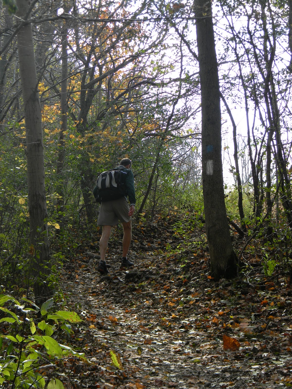
We started at the same point as our last leg, parking just off of Plover Mills Road, but headed south along the trail this time.  The first part of our hike proved to be the longest part that was on actual trail. 
We walked along the river edge of a stately country property, complete with fenced areas for horses and their paddock, admiring the home and imagining the view they must have. 


Earlier, while driving along Valley View Road, to our parking destination, we noticed many grand homes built along the bluff of the river and overlooking the valley.  Our guess is that many of these home owners are not allowing the trail to pass through their property—except for this one home owner.  A couple of new homes were being built and there was one that was being renovated that was actually having an open house that day.  We couldn’t resist stopping in for a bit—after all, how often does one get to hike AND check out a new home prospect?  The view from their back window was absolutely lovely, so we could see why this road had become a real estate hot spot.


When we had to come back up to the road, away from the river, at least we still had many vantage points from the road where we could see the river valley.  That made walking along the road much more pleasant, especially with the “painter’s palette” of colours that had transformed the summer countryside into one with autumn hues.


We reached our turn-around point in just under two hours and then headed back, looking for a place to stop for lunch. 
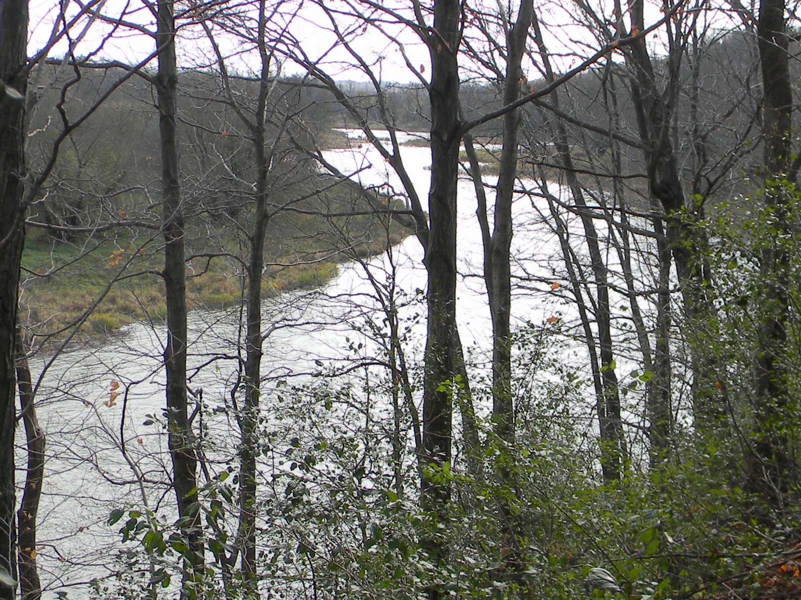
Our turn around point took us to the
north boundary of Fanshawe Cons. Area,
where we will be hiking on the next leg.
In order to find a cool spot to sit, we had to stray off of the path and head towards the river, but we found a scenic spot where we didn’t think we would be trespassing on any private property.  As long as we were certain to carry out our garbage, who could really object?  In fact, we collected one small shopping bag of cans, bottles, and other trash, thereby fulfilling one of the trail users codes...”Carry out all garbage and litter—even other people’s.”
Our riverside view for our lunch stop.
The return hike back to the car took just a bit longer, though it seemed longer than it was.  Perhaps the heat of the day was getting to us somewhat.  There was record temperatures set for Oct. 9...not sure if that was the case in this particular locale, but if not, it had to be awfully close! 
Puffballs on a rotting log--under-ripe stage.
Ripe puffballs giving off spores.
A shaded section of the trail that passed
through a wooded area, just before the
turnaround.
As we entered back along the edge of the one country property, we couldn’t resist taking our shoes and socks off and dipping our feet in the cool running water of the Thames, perching upon some rocks that were at the river’s edge. 

Paul even went as far as setting himself down between a couple of boulders, submerging his entire legs and enjoying a bit of cryotherapy.

If it had not been for the awesome views of the river valley and its colours and finally sighting a blue heron, this uninspiring section of the Thames Valley Trail would not have been so enjoyable for us. 


It would be appropriate to say that being Thanksgiving weekend, we were certainly thankful for the particulars that made this leg worth our while.  Nonetheless, section 13 has been completed, there and back, and we can look forward to hiking through Fanshawe Conservation Area on our next couple of legs.
Ripened milkweed--a thing
of beauty.
Looked for a ridge of sumac in
its vibrant red, but this was the
best we came across--not bad
though!


Cheers to Mother Earth and her beauty!
Hope everyone had a Happy Thanksgiving!