Weather: 17C at start; 22C at completion; bright sunshine with a light breeze
Duration of hike: 3 hours 44 minutes (including a 15 minute stop for lunch)
Section: 5—from Oxford
St. entrance of Komoka Provincial Park to entrance of park on Gideon Dr.
4—from
entrance to Komoka Prov. Park on Gideon Dr. to west side of Komoka Rd. bridgeDistance: 13.4 km Cumulative distance: 166.9 km
 |
| Fiddleheads anyone? |
Hiking this section was not a new experience for either of us though,
having been through these trails many times before on a Sunday hike with the
kids.
Komoka Provincial Park is a small park with few
amenities; it’s nothing like the Pinery where one can camp and enjoy a variety
of activities and services that are provided.
There isn’t an entrance fee that must be paid in order to get in. Just pull up to one of the parking areas that
offer access in, pick a trail and off you go!
Hiking is its main raison d’etre and that was certainly the case on this
sunny Sunday as we passed numerous groups of hikers of all types….especially
families with young children. This is a
great spot to take kids out for an outdoor expedition as the trails offer easy
hiking, but with lots of nature bonuses!
 |
| Small marsh located along the trail. |
 |
| Carp sunning themselves just upstream from the fisherman's hooks! |
There is the main trail that traverses the park from
east to west; that’s the Thames Valley Trail and it’s marked with the
traditional white blazes. But from the
main trail, you can choose to loop around and head off onto the Blue,
Yellow, or Orange trails. A good spot to
start is at the main Gideon Drive parking lot, hike toward the river on the
Blue trail then switch over to one of the other trails to complete a circuit.
 |
| Orange trail marker |
 |
| Blue trail marker--many of the white TV Trail blazes are metal strips in Komoka Park. |
We exited the park at its west entrance on Gideon
Drive, then continued down the road for a bit, avoiding some private land,
before turning back onto a path that went alongside of the river. We followed this until it went under the
Komoka Road bridge and came back up toward Gideon Drive. This was our turn around point for this
chapter of our adventure.
 |
| This downed tree blocked the path where the trail crossed onto private land, just before the Komoka Road Bridge |
 |
| Turn around point--telephone pole that is just west of the bridge. |
 |
| The view from our lunch time stop |
 |
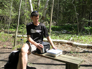
| Our lunch time stop |
 |
| One of the many ravines that cut through Komoka Park. |


No comments:
Post a Comment