Section: 12 (from Fanshawe Golf Club parking lot to Thorndale Road)
Weather: 12C, sunny; 15C at completion
Duration of hike (including a lunch stop part-way): 3 hours 20 minutes
Distance: 11.2 km Cumulative distance: 67.9 km
We’ve hiked, cycled and ran the trails on both sides of Fanshawe Lake so many times, it’s hard to determine an exact number of how many times we’ve been this way before. This particular stretch from the Fanshawe Golf Club parking lot, at the far east end of Sunningdale Road, has been a regular fixture in our hiking schedule over the years, especially when we wanted to get out with the kids on a brisk fall day.  The terrain is easy but there’s always something interesting to see along the way. And today’s leg wasn’t any different, but it was satisfying nonetheless.
The familiarity of our route made the distance pass by quickly and it was like visiting an old friend in some ways. But today, we seemed to pay closer attention to what we saw as we travelled along.
We encountered more hikers today, than any other day we’ve been out yet. With the trail passing through Fanshawe Conservation Area, this section gets a lot of visitors, including mountain bikers who ride the full route around the lake; a distance of 21km. Several times, we had to step aside and let a few cyclists pass. And we really had to keep our heads up when we were returning, because now the bikers were coming from behind us. Being an odd numbered date (the 23rd), they are supposed to follow a counter-clockwise direction around. But they always gave us fair warning and it was never a problem....a good example of how we can all share the “road”.
 The Fanshawe Conservation Area came into being after the completion of the dam in 1952. The devastating flood of 1937 brought about the need for its construction. With the creation of the lake, came a recreation area that people have been enjoying for nearly 60 years now.
We hiked north from our starting point, back to Thorndale Road, which was also our turn around on our last outing. For this post, I’m going to let the pictures tell the story for this leg.
 |
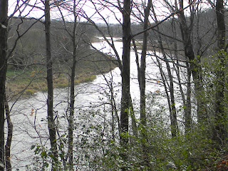
| Most of the trail along this section is high up on a bluff. I wanted to get a shot of the river and its bank, so I climbed down for a better view. |
 |
| And here I am, perched on a tree stump, at the edge of a bluff, overlooking the river. |
 |
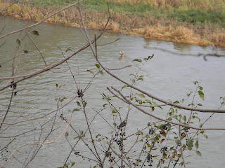
| At one point, as we walked along, we heard a big splash and wondered what on earth it was! When we looked down, we saw a buck, swimming across the river! |
 |
| Here he is getting out on the other side. |
 |
| And there he goes! |
 |
| Water levels were high on this day. We had to wade across this creek in order to continue on to the other side. |
 |
| Here we are at the turn around point at Thorndale Road--the same turn around as our last outing, just from the opposite direction. |
 |
| Heading back...climbing back up a bluff after being at water's edge. |
 |
| Where we stopped for lunch. We've used this picnic table many times in the past for the same purpose. It's a great spot, high up, with a view. |
 |
| Looking north, upstream. |
 |
| Looking south, downstream. |
 |
| The sun was shimmering off of Fanshawe Lake....brilliant! |
 |
| Not much colour left in the landscape, but this tree still had much of its green and hadn't lost many of its leaves either! |
 |
| With so many others on the trail that day, hikers and cyclists, it wasn't difficult to get someone to take our picture. |
 |
| This is the tree that we'll start our next leg from. It's at the south end of the golf course parking lot. |

Well done Kathy. Your pictures are amazing. Good luck finishing the trail.
ReplyDeleteThanks Anonymous!...whoever you are! :)
ReplyDelete