Date of hike: Sun.
July 1, 2012
Weather: 24C at start, sunny; 28C at completion (humidex of 32C)


 Today’s hike was a full-time investment, with the
distance we wanted to cover. It was a
hot one out there and we appreciated the cool shade along the creek as well as
the breeze that blew when we were on the roads or going along some farm fields.
Today’s hike was a full-time investment, with the
distance we wanted to cover. It was a
hot one out there and we appreciated the cool shade along the creek as well as
the breeze that blew when we were on the roads or going along some farm fields.


 We took a much needed lunch break at our turn around
point; the same turn around point as our last hike. The logistics of parking have sometimes made
it necessary to tackle a length of the trail from the opposite direction, this
time being one of them.
We took a much needed lunch break at our turn around
point; the same turn around point as our last hike. The logistics of parking have sometimes made
it necessary to tackle a length of the trail from the opposite direction, this
time being one of them.


Weather: 24C at start, sunny; 28C at completion (humidex of 32C)
Duration of hike: 4
hours 32 minutes
Section: 2 and 3
(from 0 km to 4.3 km point)
Distance: 16.6 km Cumulative
distance: 196.9 km

Canada Day dawned bright and sunny and hot; just like
a summer day should. What better way to celebrate the old girl’s 145th birthday than with a hike through
trails that feature some of the best of what she has to offer?


This section of the TV Trail had some of the most
challenging terrain that we’ve had to navigate so far. The meanderings along Sharon Creek and back
to the Thames had numerous climbs up and down the steep valleys formed by the
waters of the creek long ago.


Make sure
you have sturdy shoes on, that are up to the task. This is not as family friendly as Komoka
Provincial Park, but if you take your time, smaller children would enjoy some
of these winding paths that can be easily accessed from the Sharon CreekConservation Area.

 |
| West side of the Sharon Creek Dam. |
 |
| East side of the Sharon Creek Dam, forming Springer Lake. |
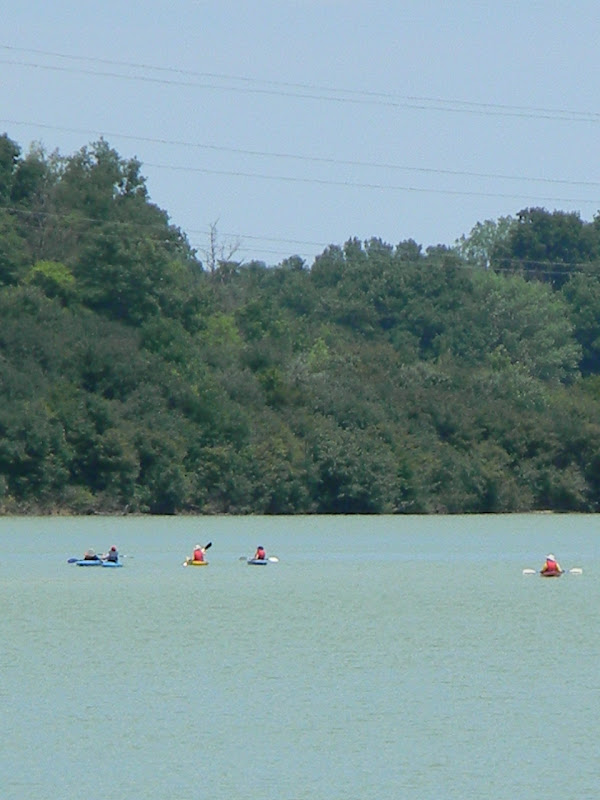 |
| Kayakers enjoying Springer Lake. |
One of the things that has always been an attraction
for me, with regards to walking the trails through the woods, has been
imagining these paths to be the roadways of days gone by. Whether it was the native people moving from
one encampment to another, or pioneer settlers travelling between homesteads,
trails such as these have always stirred my imagination. A thought made even more significant,
considering it was our nation’s birthday today and how this great country came
to be. From her beautiful natural areas
to her cities and urban centres, it’s plain to see that Canadians should be
proud!


 We took a much needed lunch break at our turn around
point; the same turn around point as our last hike. The logistics of parking have sometimes made
it necessary to tackle a length of the trail from the opposite direction, this
time being one of them.
We took a much needed lunch break at our turn around
point; the same turn around point as our last hike. The logistics of parking have sometimes made
it necessary to tackle a length of the trail from the opposite direction, this
time being one of them. 
While perched
high on a bluff, enjoying our lunch, we saw a deer scamper along the riverside
on the opposite shore. Minutes later,
three men in a flat bottom motor boat cruised by. Another few minutes later we heard several
gun shots. We wondered, was this an
example of some of the illegal hunting that the trail had been re-routed for in
this particular area? Whatever the
truth of the matter was, we cautiously began our return trip, wary of where the
shooters were. We never did see anyone,
nor did we come close to where the gun shots seemed to be coming from, making our way safely onward.


 |
| The Thames River--some final views. |
In completing this section of the trail, this will be
the last time we see the Thames River.
The final section of the trail that we will complete will head south so
as to connect to the Elgin Trail. We are
so close to the end of our destination; it won’t be long now!

Four-footed and winged friends we encountered.

 |
| Blue heron...coming in for a landing on Springer Lake |
 |
| Hawk tail feather |

No comments:
Post a Comment