Saturday, October 29, 2011

Been There....Done That!

Date of hike:  Sun. Oct. 23, 2011      
Section: 12 (from Fanshawe Golf Club parking lot to Thorndale Road)                      
Weather:  12C, sunny; 15C at completion
Duration of hike (including a lunch stop part-way):  3 hours 20 minutes  
Distance:  11.2 km   Cumulative distance:  67.9 km
We’ve hiked, cycled and ran the trails on both sides of Fanshawe Lake so many times, it’s hard to determine an exact number of how many times we’ve been this way before.  This particular stretch from the Fanshawe Golf Club parking lot, at the far east end of Sunningdale Road, has been a regular fixture in our hiking schedule over the years, especially when we wanted to get out with the kids on a brisk fall day. 

The terrain is easy but there’s always something interesting to see along the way.  And today’s leg wasn’t any different, but it was satisfying nonetheless.

The familiarity of our route made the distance pass by quickly and it was like visiting an old friend in some ways.  But today, we seemed to pay closer attention to what we saw as we travelled along. 
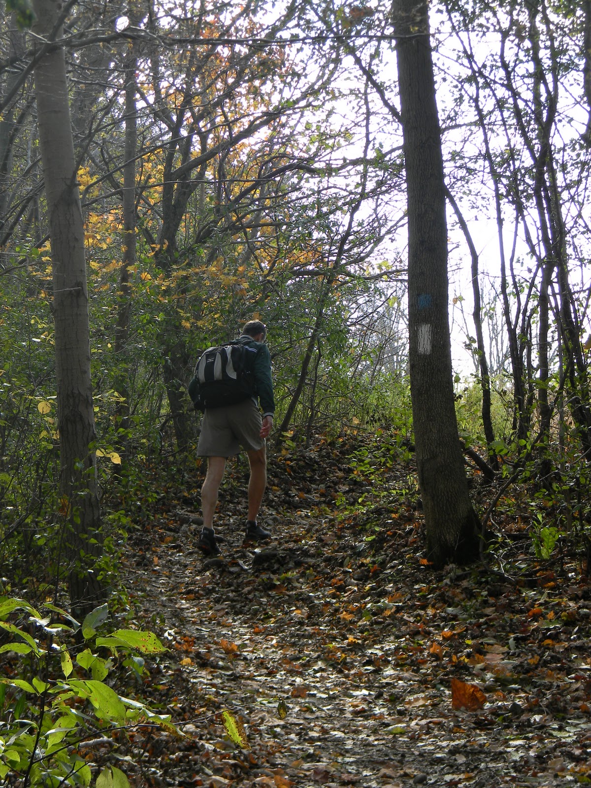
We encountered more hikers today, than any other day we’ve been out yet.  With the trail passing through Fanshawe Conservation Area, this section gets a lot of visitors, including mountain bikers who ride the full route around the lake; a distance of 21km.  Several times, we had to step aside and let a few cyclists pass.  And we really had to keep our heads up when we were returning, because now the bikers were coming from behind us.  Being an odd numbered date (the 23rd), they are supposed to follow a counter-clockwise direction around.  But they always gave us fair warning and it was never a problem....a good example of how we can all share the “road”.
The Fanshawe Conservation Area came into being after the completion of the dam in 1952.  The devastating flood of 1937 brought about the need for its construction.  With the creation of the lake, came a recreation area that people have been enjoying for nearly 60 years now. 


We hiked north from our starting point, back to Thorndale Road, which was also our turn around on our last outing.  For this post, I’m going to let the pictures tell the story for this leg.
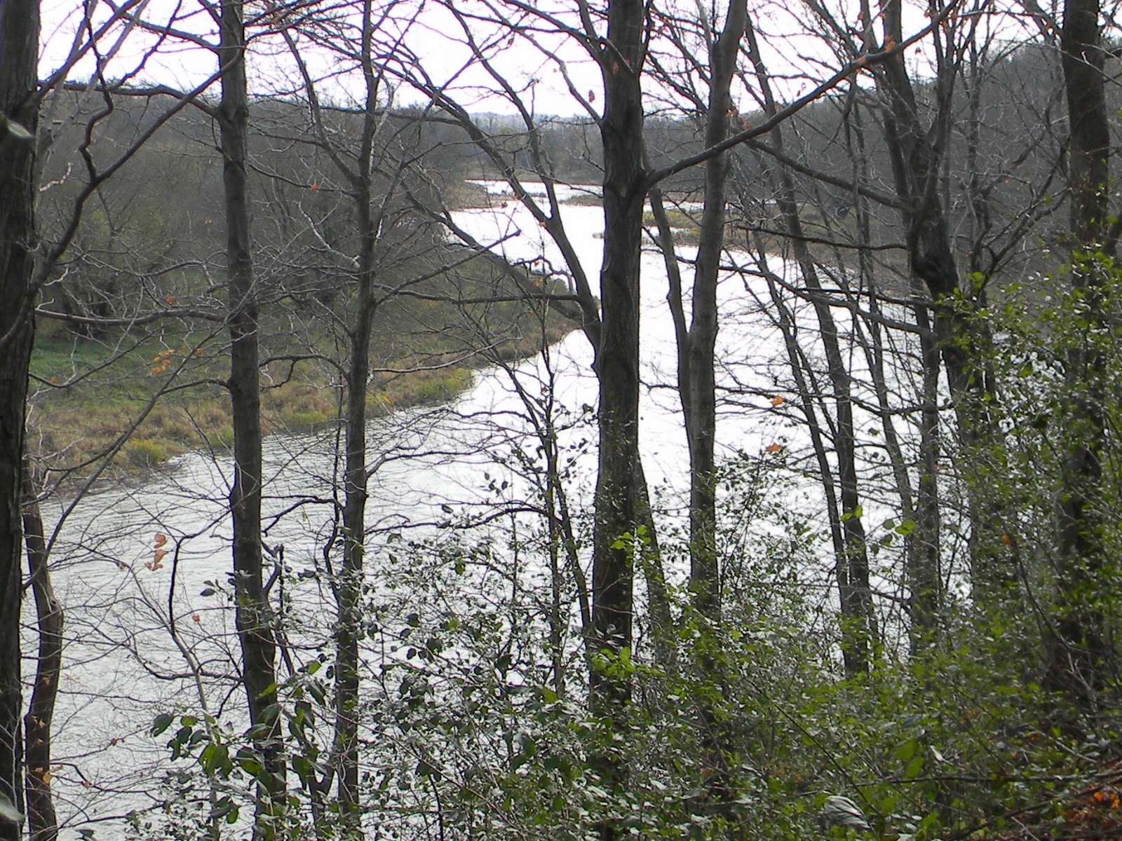
Most of the trail along this section is high up on a
bluff.  I wanted to get a shot of the river and its
bank, so I climbed down for a better view.
And here I am, perched on a tree
stump, at the edge of a bluff,
overlooking the river.
At one point, as we walked along, we heard a big
splash and wondered what on earth it was!  When
we looked down, we saw a buck, swimming across
the river!
Here he is getting out on the other side.

And there he goes!
Water levels were high on this day.  We
had to wade across this creek in order to
continue on to the other side.
Here we are at the turn around point at
Thorndale Road--the same turn around
as our last outing, just from the
opposite direction.
Heading back...climbing back up a
bluff after being at water's edge.
Where we stopped for lunch.  We've used this picnic
table many times in the past for the same purpose.
It's a great spot, high up, with a view.


Looking north, upstream.
Looking south, downstream.
The sun was shimmering off of
Fanshawe Lake....brilliant!
Not much colour left in the landscape,
but this tree still had much of its green
and hadn't lost many of its leaves either!
With so many others on the trail that day, hikers and
cyclists, it wasn't difficult to get someone to take
our picture.
This is the tree that we'll start our next
leg from.  It's at the south end of the
golf course parking lot.

Sunday, October 16, 2011

Thankful for the “Valley View”

Date of hike:  Sun. Oct. 9, 2011   Weather:  21C, sunny; 26C at completion

Section:  13

Duration of hike (including a 20 minute lunch stop part-way):  4 hours 26 minutes  

Distance:  15.6 km

Cumulative distance:  56.7 km

Section 13 of the Thames Valley Trail does not travel along much of a trail per se....in fact, over half of it follows Valley View Road, a gravel side road.  But on this glorious fall day (or should I say summer-like), the brilliant fall colours that were seen in every direction, made this excursion a bit more bearable.


We started at the same point as our last leg, parking just off of Plover Mills Road, but headed south along the trail this time.  The first part of our hike proved to be the longest part that was on actual trail. 
We walked along the river edge of a stately country property, complete with fenced areas for horses and their paddock, admiring the home and imagining the view they must have. 


Earlier, while driving along Valley View Road, to our parking destination, we noticed many grand homes built along the bluff of the river and overlooking the valley.  Our guess is that many of these home owners are not allowing the trail to pass through their property—except for this one home owner.  A couple of new homes were being built and there was one that was being renovated that was actually having an open house that day.  We couldn’t resist stopping in for a bit—after all, how often does one get to hike AND check out a new home prospect?  The view from their back window was absolutely lovely, so we could see why this road had become a real estate hot spot.


When we had to come back up to the road, away from the river, at least we still had many vantage points from the road where we could see the river valley.  That made walking along the road much more pleasant, especially with the “painter’s palette” of colours that had transformed the summer countryside into one with autumn hues.


We reached our turn-around point in just under two hours and then headed back, looking for a place to stop for lunch. 
Our turn around point took us to the
north boundary of Fanshawe Cons. Area,
where we will be hiking on the next leg.
In order to find a cool spot to sit, we had to stray off of the path and head towards the river, but we found a scenic spot where we didn’t think we would be trespassing on any private property.  As long as we were certain to carry out our garbage, who could really object?  In fact, we collected one small shopping bag of cans, bottles, and other trash, thereby fulfilling one of the trail users codes...”Carry out all garbage and litter—even other people’s.”
Our riverside view for our lunch stop.
The return hike back to the car took just a bit longer, though it seemed longer than it was.  Perhaps the heat of the day was getting to us somewhat.  There was record temperatures set for Oct. 9...not sure if that was the case in this particular locale, but if not, it had to be awfully close! 
Puffballs on a rotting log--under-ripe stage.
Ripe puffballs giving off spores.
A shaded section of the trail that passed
through a wooded area, just before the
turnaround.
As we entered back along the edge of the one country property, we couldn’t resist taking our shoes and socks off and dipping our feet in the cool running water of the Thames, perching upon some rocks that were at the river’s edge. 

Paul even went as far as setting himself down between a couple of boulders, submerging his entire legs and enjoying a bit of cryotherapy.

If it had not been for the awesome views of the river valley and its colours and finally sighting a blue heron, this uninspiring section of the Thames Valley Trail would not have been so enjoyable for us. 


It would be appropriate to say that being Thanksgiving weekend, we were certainly thankful for the particulars that made this leg worth our while.  Nonetheless, section 13 has been completed, there and back, and we can look forward to hiking through Fanshawe Conservation Area on our next couple of legs.
Ripened milkweed--a thing
of beauty.
Looked for a ridge of sumac in
its vibrant red, but this was the
best we came across--not bad
though!


Cheers to Mother Earth and her beauty!
Hope everyone had a Happy Thanksgiving!

Saturday, October 08, 2011

Of Bridges and Boardwalks...Of Flora and Fauna....

Date of hike:  Sun. Sept. 18, 2011              Weather:  15C, sunny; 20C at completion
Section: 14
Duration of hike (including a brief lunch stop part-way):  5 hours   Distance:  16.6 km
Cumulative distance:  41.1 km
With the goal of trying to be on the portion of the trail that passes through London by the time the snow flies, we had made a plan of what legs we needed to do and when we might do them.  This leg of the trail was our longest one to date and would require a significant amount of time.  We could’ve broken it up into two smaller legs, but that would mean another Saturday or Sunday afternoon, and that just didn’t work out in our timeline.  So, off we set, one bright and sunny Sunday morning, with lunch and snacks packed, to tackle this 10+ mile section.


Like the previous two legs, this section offered its own unique aspects as will be detailed.  We chose to make our start/finish point of the last hike the turn-around point, as this allowed us to read the trail description in the forward direction rather than the reverse direction.  The terrain was varied; from steep hillside ravines to low-lying flat flood plains.  The air was brisk and had an autumn-like quality to it and we definitely saw the season beginning to turn.

We parked the car just off of Plover Mills Road and headed out along the edge of a farm pasture under the curious eyes of some grazing cattle.  The trail soon went into the woods and alternated back out into open grassy areas.  As we made our way, the trail started to traverse along steeper hillsides with ravines cutting through.  Every one of these ravines had a bridge crossing it, so that made it easy to get across.  Likewise, in the low-lying grassy areas, several boardwalks kept us up and over the wet marshy ground.  In all, we counted a total of 16 bridges and/or boardwalks that were in place for the hiker’s convenience and all thanks to one generous donor who had provided the materials for their construction.
 
While the trees weren’t giving much indication with regards to the looming approach of fall, there were other signs that were apparent.  The brilliant glow of the goldenrod with the contrast of the majestic purple of the wild asters was out in full force.  Some late blooming black-eyed Susan along with these tall stalked yellow blooming wild flower added more colour to the trailside as well.


The trail guide advised us to watch for some large boulders that would have been deposited by the glaciers twenty-five thousand years ago.  We found those as well as some even larger ones....amazing!

One particular section of the trail passed through what was obviously a floodplain, making one realize that in spite of its often bucolic demeanour, the Thames River can be a force that also demands respect.

Soon we could hear the sound of vehicles zipping along Highway 7 and we knew we were close to the turn-around.  This was the first time we have had to cross the river along the trail and the bridge offered a good vantage point for some lovely views of the lazy river.  We made our way across the bridge, touched the sign post of the start/finish point of the last leg, and then headed back.


Shortly after turning around, we found a spot to sit and eat our lunch.  During that brief stop, we encountered another hiker on the trail—a young woman out walking her dog—something she said that she did regularly along this section of the trail.  She seemed just as surprised to see us as this does not seem to be a section of the trail that gets many passersby.  So far, other than her and one other couple that we passed going the opposite direction that day, that has been the only other hikers we’ve seen.


Another visitor that we had during our break was this Praying Mantis.  It seemed to have some kind of an affinity to me because no matter what I did to try and escape from it, it always found me yet again.  Good thing I’m not too squeamish about things like that!

When we were almost back to the car, we came upon this little fellow, sunning himself on the trail.  He was so small that we nearly stepped on him—good thing we didn’t!  If you look closely enough, you can see some of the river mud still caked on him.  The Thames is home to the snapping turtle species—one that is listed as a “Species of Special Concern” due to its late breeding age and survival challenges for eggs and the hatched young.  It’s always a good sign of health for a river when there are turtles; hopefully this is a sign of their comeback on the river. 

Before finishing off this very long trek, we checked to see where we might possibly pick up the next leg, if we decide to start from this end.  I felt tired after being out for almost 5 hours, but not as tired as I was after the first leg, which was much shorter.  Perhaps I’m building up my hiker’s endurance factor?  At any rate, exploring the TVT to this point in time has been rewarding on many levels indeed!