Sunday, October 16, 2011

Thankful for the “Valley View”

Date of hike:  Sun. Oct. 9, 2011   Weather:  21C, sunny; 26C at completion

Section:  13

Duration of hike (including a 20 minute lunch stop part-way):  4 hours 26 minutes  

Distance:  15.6 km

Cumulative distance:  56.7 km

Section 13 of the Thames Valley Trail does not travel along much of a trail per se....in fact, over half of it follows Valley View Road, a gravel side road.  But on this glorious fall day (or should I say summer-like), the brilliant fall colours that were seen in every direction, made this excursion a bit more bearable.


We started at the same point as our last leg, parking just off of Plover Mills Road, but headed south along the trail this time.  The first part of our hike proved to be the longest part that was on actual trail. 
We walked along the river edge of a stately country property, complete with fenced areas for horses and their paddock, admiring the home and imagining the view they must have. 


Earlier, while driving along Valley View Road, to our parking destination, we noticed many grand homes built along the bluff of the river and overlooking the valley.  Our guess is that many of these home owners are not allowing the trail to pass through their property—except for this one home owner.  A couple of new homes were being built and there was one that was being renovated that was actually having an open house that day.  We couldn’t resist stopping in for a bit—after all, how often does one get to hike AND check out a new home prospect?  The view from their back window was absolutely lovely, so we could see why this road had become a real estate hot spot.


When we had to come back up to the road, away from the river, at least we still had many vantage points from the road where we could see the river valley.  That made walking along the road much more pleasant, especially with the “painter’s palette” of colours that had transformed the summer countryside into one with autumn hues.


We reached our turn-around point in just under two hours and then headed back, looking for a place to stop for lunch. 
Our turn around point took us to the
north boundary of Fanshawe Cons. Area,
where we will be hiking on the next leg.
In order to find a cool spot to sit, we had to stray off of the path and head towards the river, but we found a scenic spot where we didn’t think we would be trespassing on any private property.  As long as we were certain to carry out our garbage, who could really object?  In fact, we collected one small shopping bag of cans, bottles, and other trash, thereby fulfilling one of the trail users codes...”Carry out all garbage and litter—even other people’s.”
Our riverside view for our lunch stop.
The return hike back to the car took just a bit longer, though it seemed longer than it was.  Perhaps the heat of the day was getting to us somewhat.  There was record temperatures set for Oct. 9...not sure if that was the case in this particular locale, but if not, it had to be awfully close! 
Puffballs on a rotting log--under-ripe stage.
Ripe puffballs giving off spores.
A shaded section of the trail that passed
through a wooded area, just before the
turnaround.
As we entered back along the edge of the one country property, we couldn’t resist taking our shoes and socks off and dipping our feet in the cool running water of the Thames, perching upon some rocks that were at the river’s edge. 

Paul even went as far as setting himself down between a couple of boulders, submerging his entire legs and enjoying a bit of cryotherapy.

If it had not been for the awesome views of the river valley and its colours and finally sighting a blue heron, this uninspiring section of the Thames Valley Trail would not have been so enjoyable for us. 


It would be appropriate to say that being Thanksgiving weekend, we were certainly thankful for the particulars that made this leg worth our while.  Nonetheless, section 13 has been completed, there and back, and we can look forward to hiking through Fanshawe Conservation Area on our next couple of legs.
Ripened milkweed--a thing
of beauty.
Looked for a ridge of sumac in
its vibrant red, but this was the
best we came across--not bad
though!


Cheers to Mother Earth and her beauty!
Hope everyone had a Happy Thanksgiving!

Saturday, October 08, 2011

Of Bridges and Boardwalks...Of Flora and Fauna....

Date of hike:  Sun. Sept. 18, 2011              Weather:  15C, sunny; 20C at completion
Section: 14
Duration of hike (including a brief lunch stop part-way):  5 hours   Distance:  16.6 km
Cumulative distance:  41.1 km
With the goal of trying to be on the portion of the trail that passes through London by the time the snow flies, we had made a plan of what legs we needed to do and when we might do them.  This leg of the trail was our longest one to date and would require a significant amount of time.  We could’ve broken it up into two smaller legs, but that would mean another Saturday or Sunday afternoon, and that just didn’t work out in our timeline.  So, off we set, one bright and sunny Sunday morning, with lunch and snacks packed, to tackle this 10+ mile section.


Like the previous two legs, this section offered its own unique aspects as will be detailed.  We chose to make our start/finish point of the last hike the turn-around point, as this allowed us to read the trail description in the forward direction rather than the reverse direction.  The terrain was varied; from steep hillside ravines to low-lying flat flood plains.  The air was brisk and had an autumn-like quality to it and we definitely saw the season beginning to turn.

We parked the car just off of Plover Mills Road and headed out along the edge of a farm pasture under the curious eyes of some grazing cattle.  The trail soon went into the woods and alternated back out into open grassy areas.  As we made our way, the trail started to traverse along steeper hillsides with ravines cutting through.  Every one of these ravines had a bridge crossing it, so that made it easy to get across.  Likewise, in the low-lying grassy areas, several boardwalks kept us up and over the wet marshy ground.  In all, we counted a total of 16 bridges and/or boardwalks that were in place for the hiker’s convenience and all thanks to one generous donor who had provided the materials for their construction.
 
While the trees weren’t giving much indication with regards to the looming approach of fall, there were other signs that were apparent.  The brilliant glow of the goldenrod with the contrast of the majestic purple of the wild asters was out in full force.  Some late blooming black-eyed Susan along with these tall stalked yellow blooming wild flower added more colour to the trailside as well.


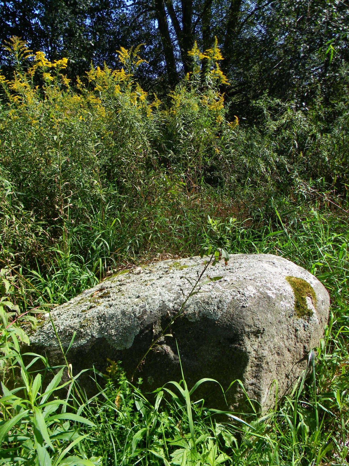
The trail guide advised us to watch for some large boulders that would have been deposited by the glaciers twenty-five thousand years ago.  We found those as well as some even larger ones....amazing!

One particular section of the trail passed through what was obviously a floodplain, making one realize that in spite of its often bucolic demeanour, the Thames River can be a force that also demands respect.

Soon we could hear the sound of vehicles zipping along Highway 7 and we knew we were close to the turn-around.  This was the first time we have had to cross the river along the trail and the bridge offered a good vantage point for some lovely views of the lazy river.  We made our way across the bridge, touched the sign post of the start/finish point of the last leg, and then headed back.


Shortly after turning around, we found a spot to sit and eat our lunch.  During that brief stop, we encountered another hiker on the trail—a young woman out walking her dog—something she said that she did regularly along this section of the trail.  She seemed just as surprised to see us as this does not seem to be a section of the trail that gets many passersby.  So far, other than her and one other couple that we passed going the opposite direction that day, that has been the only other hikers we’ve seen.


Another visitor that we had during our break was this Praying Mantis.  It seemed to have some kind of an affinity to me because no matter what I did to try and escape from it, it always found me yet again.  Good thing I’m not too squeamish about things like that!

When we were almost back to the car, we came upon this little fellow, sunning himself on the trail.  He was so small that we nearly stepped on him—good thing we didn’t!  If you look closely enough, you can see some of the river mud still caked on him.  The Thames is home to the snapping turtle species—one that is listed as a “Species of Special Concern” due to its late breeding age and survival challenges for eggs and the hatched young.  It’s always a good sign of health for a river when there are turtles; hopefully this is a sign of their comeback on the river. 

Before finishing off this very long trek, we checked to see where we might possibly pick up the next leg, if we decide to start from this end.  I felt tired after being out for almost 5 hours, but not as tired as I was after the first leg, which was much shorter.  Perhaps I’m building up my hiker’s endurance factor?  At any rate, exploring the TVT to this point in time has been rewarding on many levels indeed!


Monday, September 05, 2011

Perfect Timing!

Date of hike:  Sun. Sept. 4, 2011     
Section:  15--its southerly end; from 0 to 7.3 km                          
Weather:  22C, 96% humidity, overcast, light rain at times
Duration of hike (including a brief lunch stop part-way):  4 hours 20 minutes   Distance:  14.6 km
Cumulative distance:  24.6 km

For the second leg of our hike, we would be completing Section 15 of the trail.  Instead of starting at the end point of our first leg, we chose to make that our turn-around point and started from the opposite end. So we parked the car just off of Highway 7 at Blanshard Line 1 and, in spite of some looming rain clouds, we headed out.  There only ended up being a few light sprinkles for the duration of the hike, so we were glad that we decided to go. The road serves as the entrance to the River Valley Golf and Country Club, so it wasn’t hard to find. 
 
Walking along the road, we very soon came to the 3rd tee of the golf course, which was where we crossed a gully using a golf cart bridge.  Staying to the edge of the first and second fairways, we kept our eyes open for any stray golf balls that might come our way.  It wasn’t very far before we left the golf course property and headed onto the trail.
                                                               

This section of the trail was along some relatively low lying areas by the Thames River, with one or two small climbs up and down some bluffs.  These climbs took us away from the river a bit and usually through some wooded areas.  Much of the trail was made up of old farmer's tracks.  There was even one spot where the track lead right into the river--a spot where farmers once forded the river to the village of Rannoch.


When walking along the river, it was incredibly quiet and peaceful.  The air was heavy with humidity with little wind; but every so often, a light breeze would offer some respite.  All you could hear was the trickle of water over the river bed rocks and the sounds of some kingfishers working out a dispute.  Paul even thought he saw a bald eagle swoop out of the trees and dive down to the water, catching a fish.  Or it might have been an osprey.  Whatever it was, it was a very large bird with a white head.  We expected and hope to see at least one blue heron—very common along the Thames River—but no such luck today.

One section along the river’s edge was deceptively challenging to maneuver.  Here, we were walking on the rock bed of the river, but the rocks were covered in grass.  While the river level was very low at this time of the year, the rocks were still a bit slippery and uneven, and consequently we had to be very careful about foot placement.

But the views of the river along the way were nothing but peaceful and serene.  With the exception of a few farm fields that we passed, there was little to indicate that civilization was nearby.  Not even a farm house or barn was seen along this stretch. 

Here we are at our turn around point--7.3 km from where we started.  Recognize this spot?  You should, because this was our turn around for the first leg--but we came from the opposite direction.


We did see lots of evidence of animal life though.  A muskrat or ground hog hole was discovered by the river’s edge and you could see a path from the bordering corn field to the entrance of a burrow, where the animal has been busily stocking up for the winter.  We came across remnants of what looked to be a seafood feast at one time—empty clam shells were left behind, long after the river had receded from its spring levels.  And one edge of a corn field had been trampled and the corn consumed by deer, by the looks of the hoof prints in the dirt.

Signs of fall were apparent as well with the fruit of wild trees and vines showing in full force and just a hint of change of colour in the leaves.  I suspect our next hike will offer a greater show of colour.  It will be interesting to see the changes as the seasons pass. 


I love the massive willows that grow along the edge of the Thames River in many places and this section of the trail had more than its share.  There was a variety of different plants and trees, including the stinging nettle that both Paul and I managed to have a run-in with.


As we turned back to the car, it’s always surprising how much faster the return trip seems to go.  Before we knew it, we were at the edge of the golf course once again.  This time, someone was teeing off at hole #1 and while picking up stray golf balls, we heard the ball crack off of the tree and out of bounds.  Must be a difficult first hole because we found 16 balls—not a bad treasure trove and probably enough to get us through our next game for sure!  And just as we finished, the rain that had been promised, finally started to fall....perfect timing!